GIS for Targeted Expansion: Spatial intelligence to identify underserved geographies and optimize resource deployment
Summary
Impact Created
1.56 million
girls enrolled in just 6 years
7x faster
impact compared to the previous model
90%
model accuracy with major cost and time savings
About the organisation
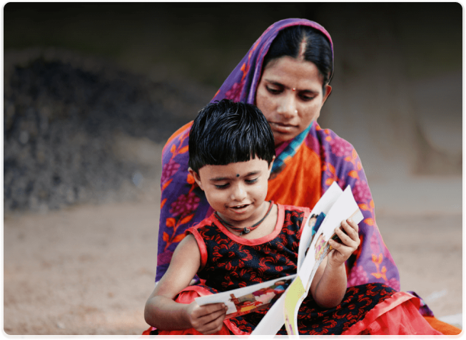
Educate Girls is a non-profit working in India’s rural and educationally backward districts to improve girls’ enrollment, retention, and learning outcomes. It mobilizes communities and leverages public systems to close gender gaps in education.
Problem Statement
As outreach expanded, on-ground operations became inefficient due to manual planning, redundant travel, uneven workload, and limited oversight—creating a need for a system to streamline daily execution, enhance visibility, and improve staff accountability across large geographies.
Solution
A GIS-powered planning tool was developed by integrating spatial data into the mobile MIS, enabling real-time mapping, automated cluster generation, and route optimization. Built with user input and rolled out in phases, the tool empowered field teams with data-driven planning, transparency, and operational efficiency.
Learnings
- Planning became more strategic with spatial tools enabling equitable, data-driven field coordination.
- Staff deployment bias reduced through automated clustering, ensuring fair workload distribution.
- Accountability improved as digital schedules allowed real-time monitoring of planned vs. actual activity.
Key Technologies Used
- GIS Software
- Spatial Clustering Models
- Custom Dashboards
Quick Facts

Organisation Name
Educate Girls

Organisation Website
Visit Site

Founding Year
2007

Number of Beneficiaries served
1.56 million out-of-school girls enrolled (as of 2023); 18 million+ beneficiaries reached through outreach and engagement

Geography Served
Rajasthan, Madhya Pradesh, Uttar Pradesh

Focus Area
Programmatic Impact and Strategic Expansion

Functions Impacted
Geographic Targeting; Expansion Planning; Field Deployment; Monitoring & Evaluation

SDG Addressed


Full Case Study
Challenges
Manual planning and limited oversight created bottlenecks in daily execution across vast geographies.
As Educate Girls scaled its outreach, ensuring daily execution efficiency across vast geographies became a major challenge. While strategic targeting helped identify high-need geographies, the on-ground field operations were hindered by manual planning, inefficient travel routes, uneven workload distribution, and limited oversight. There was a pressing need to develop a system that could improve operational coordination, real-time visibility, and staff accountability.
Solution
A spatial intelligence platform streamlined field operations with automated clustering, route optimization, and real-time visibility.
The development of the GIS-based solution at Educate Girls was a result of deliberate, phased innovation aimed at addressing the execution gap in field operations. The team approached this with three guiding principles: data-driven planning, spatial efficiency, and user-centric design.
- Leveraging Existing Infrastructure for Location Intelligence: Educate Girls enhanced its existing mobile information system by integrating geospatial intelligence. By formalizing the use of location data from staff attendance and household visits, it built a rich spatial dataset covering villages, households, and schools for future analysis.
- GIS System Architecture and Data Integration: To enable geospatial mapping, the technical team integrated a QGIS server into the MIS and used shapefiles from Maps of India to map administrative units at the village level. Alignment with ground realities was ensured through internal validation using field-captured coordinates.
- User Experience and Functional Modules: Educate Girls designed intuitive GIS modules with direct input from field users to ensure relevance and ease of use:
- Coverage View - Visualizes schools and households across geographies
- Heat Map Module - Maps performance indicators spatially for quick insights
- Cluster Generator - Groups villages based on proximity and program needs
- Planning Interface - Helps coordinators prioritize visits using spatial data
All modules were built for scalability, offline use, and cross-level access, enabling district managers, block officers, and field staff to engage with the platform effectively.
Solution Roll-Out Approach
Educate Girls adopted a structured, phased rollout to ensure the GIS-based operational planning tool was tested, refined, and scaled effectively across its geographies.
The first deployment was conducted in Shahjahanpur district, Uttar Pradesh. The pilot focused on validating three core modules: cluster generation, village-level overlays, and the planning interface for field teams. This phase tested the tool’s usability and its impact on coordination and workload distribution.
Following the pilot, feedback from district officers and field staff informed critical updates. Inputs included the need to accommodate geographic nuances like rivers or poor road access, enable granular household prioritization, and offer flexibility for field disruptions. These insights shaped improvements in the user interface, filters, scoring ranges, and logic.
With enhancements in place, the solution was scaled across 17 districts in Uttar Pradesh and Madhya Pradesh. A structured onboarding process ensured readiness at all levels:
- District and block officers received targeted training
- Field coordinators were onboarded through simplified walkthroughs
- Geo-tagged datasets were preloaded to ensure seamless local use
To support adoption among field coordinators, the planning module was introduced more gradually Staff began using it to plan daily visits, prioritize households, and submit schedules in advance. Early signs indicated improved route consistency, reduced manual edits, and greater alignment between planned and actual field activity.
Outcomes & Impact
The solution reduced travel redundancy, balanced workloads, and empowered teams with data-backed execution tools.
The GIS solution delivered both measurable operational gains and significant shifts in field practice and accountability.
Quantitative Improvements
- Enhanced time efficiency by reducing travel redundancies and improving daily route planning
- Achieved consistent field coverage across clusters with equitable distribution of staff workload
- Enabled data-driven central planning with the ability to adjust field plans in real time
Qualitative Outcomes
- Replaced manual cluster assignments with objective, location-based logic, removing human bias
- Empowered supervisors with visibility into planned vs. actual activity, improving transparency
- Fostered greater ownership among field teams, reinforcing accountability for coverage and executionTop of FormBottom of Form
Tech Stack
| Component | Description |
|---|---|
| Mobile MIS | Offline-first application used by field staff for data collection and operational planning |
| QGIS Server | Geospatial engine used for spatial analysis, mapping, and integration with existing MIS platform |
| Shape Files (Maps of India) | Official administrative boundary data, aligned with ground realities using field-collected GPS |
Key Project Learnings
The implementation of a GIS-based planning system yielded not only operational benefits but also strategic insights for program design, staff deployment, and data infrastructure. As the tool evolved, it revealed important lessons about technology adoption in field-intensive settings.
Planning Became More Strategic
Geospatial tools enabled more informed, equitable, and efficient field coordination across large geographies.Bias in Staff Deployment Was Minimized
Objective clustering replaced manual allocation, reducing subjective decisions and workload disparities.-
Digital Planning Strengthened Accountability
Tracking adherence to scheduled plans improved monitoring and transparency at all field levels. -
Ground-Truthing Is Essential
Limitations in publicly available shape files highlighted the value of validating spatial data with on-ground GPS inputs.
Adaptability In the Sector
| Use Case / Sector | How the GIS Model Can Be Applied |
|---|---|
| Public Health (e.g., Immunisation, Nutrition) | Plan and monitor field staff visits to households based on high-need clusters; track real-time service coverage gaps. |
| WASH (Water, Sanitation & Hygiene) | Identify underserved communities for targeted sanitation or water interventions using geospatial clustering. |
| Agriculture Extension Services | Map and segment farm plots or villages by crop type, risk factors, or support needs; optimize field agent deployment. |
| Livelihoods & Skilling Programs | Cluster rural or urban areas based on unemployment or income data to prioritize outreach and skill-building sessions. |
| Disaster Response & Preparedness | Plan relief operations using real-time spatial data and prioritize vulnerable zones for early response and resource deployment. |
| Education System Strengthening | Identify school-access gaps or low-retention areas to plan cluster-based teacher deployment or infrastructure upgrades. |