SEEDS: AI for Resilient Cities: Hyperlocal Risk Mapping for Inclusive Climate Action
Strengthening Climate Resilience through Predictive, Community-Led Risk Intelligence
Watch the story in 60 seconds (AI-generated video; visuals are illustrative)
Case at a Glance
SEEDS (Sustainable Environment and Ecological Development Society) is a not-for-profit organisation working to protect lives and livelihoods through community-led, resilience-based solutions. Since 1994, SEEDS has supported vulnerable communities across disaster risk reduction, climate adaptation, resilient infrastructure, and nature-based solutions, with operations across India and Asia.
India faces increasing climate and disaster risks from heatwaves and floods to cyclones and earthquakes disproportionately affecting people living in informal settlements. Disaster planning remains reactive and lacks granular, real-time data, making it difficult to identify the most vulnerable households and take early, targeted action.
SEEDS developed an AI-driven, hyperlocal risk mapping system that integrates satellite imagery, geospatial layers, environmental indicators, and household data to generate building-level, multi-hazard vulnerability scores. The system enables governments and communities to anticipate risks, prioritise interventions, and implement preventive, community-led resilience measures.
As climate risks intensified, SEEDS observed systemic gaps that limited effective disaster preparedness and climate resilience planning:

These challenges underscored the need for an evidence-based, predictive, and inclusive model that could identify climate risks before disasters occurred.
SEEDS built an AI-powered, multi-hazard risk mapping platform that combines:
- Satellite imagery and land-use data
- Meteorological and time-series climate data
- Building footprints, roof types, and vegetation cover
- Population density and household surveys

Using spatial analysis, supervised learning, and forecasting models, the system generates hyperlocal vulnerability scores for heat, floods, cyclones, and earthquakes. Interactive GIS dashboards support planners and field teams, while adaptive learning loops integrate sensor data and community feedback to continuously refine risk assessments.
- Reached approximately 1,00,000 families across 10 cities including Delhi, Nagpur, Chennai, and Bhubaneswar
- Achieved 85–88% accuracy in identifying multi-hazard risks
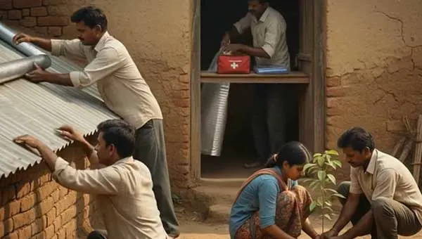
- Enabled insulation of 1,650+ high-risk homes, reducing indoor temperatures by 8–12°C
- Improved efficiency of resource targeting by 40%
- Increased community awareness by 72–75% through AI-driven advisories
- Supported integration of AI insights into Heat Action Plans and Flood Preparedness Plans
Technology Stack
| Tools/ Techniques | Used For | What It Enabled | Category |
|---|---|---|---|
| Satellite Imagery & Geospatial Layers | Risk mapping | Building-level vulnerability assessment | Open Source |
| Python, TensorFlow, Scikit-learn | Model development | Spatial analysis and supervised learning | Open Source |
| QGIS | Visualisation | Interactive GIS dashboards | Open Source |
| GeoJSON Standards | Data exchange | Interoperable mapping and analysis | Open Source |
| TensorFlow, PyTorch, OpenCV | Model development | Training and deployment of CV models | Open Source |
| OpenStreetMap (planned) | Base imagery | Imagery-agnostic scalability | Open Source |
Key Project Learnings
Building-level risk insights enabled precise targeting, leading to measurable reductions in heat exposure.
Shifting from reactive response to predictive planning improved preparedness and reduced downstream losses.
Integrating local inputs improved accuracy, trust, and adoption of AI-driven advisories.
Potential for Wider Adoption
| Sector | Adaptability of the Solution |
| Government Systems | Integration into Heat Action Plans and disaster management systems |
| Urban Local Bodies | Reusable AI backbone for early learning interventions |
| Civil Society Organisations | Community-led climate adaptation and preparedness initiatives |
See it in Action

This video features Trevor Noah visiting SEEDS in New Delhi, where AI is used to assess heat risk at the level of individual homes using satellite imagery and real-time data. It demonstrates how predictive models identify vulnerable households, estimate indoor temperatures during heatwaves, and guide simple interventions such as roof insulation to reduce heat exposure and improve community resilience.