
Farmers for Forest: Smart Stack Enables Agroforestry Scale
F4F's Hybrid Tech Stack Revolutionizes Agroforestry Monitoring and Programmatic Scale
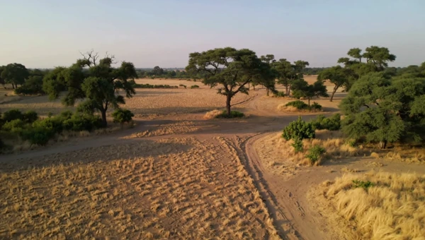
Watch the story in 60 seconds (AI-generated video; visuals are illustrative)
Case at a Glance
Founded in December 2019, Farmers for Forests (F4F) is a pioneering organization dedicated to fostering climate resilience and sustainable livelihoods through tech-enabled agroforestry. Operating across Maharashtra, Gujarat, Karnataka, Jharkhand, and Chennai, F4F empowers smallholder farmers to restore degraded land, enhance biodiversity, and generate verifiable ecosystem services.
F4F struggled to accurately monitor its remote agroforestry projects, and lacked integrated systems for farmer data, project tracking, and donor reporting-limiting its ability to scale and demonstrate credible impact for carbon credit generation and funder reporting.
F4F prioritized tech-enabled monitoring and verification, deploying a hybrid suite of open-source GIS tools, AI-based drone imagery analysis, and integrated off-the-shelf platforms. This enabled accurate, scalable monitoring of tree survival and growth, streamlining internal operations and enhancing stakeholder reporting, all while building strong internal tech capacity.
Farmers for Forests (F4F) confronted two critical, interconnected challenges that threatened its core mission and scalability:
These challenges severely impacted F4F's operational efficiency, limiting its ability to onboard new farmers quickly, provide timely support, and verify environmental outcomes like carbon sequestration. The inability to produce robust, verifiable impact data directly hindered credibility with funders, governments, and carbon certification bodies, delaying access to crucial climate finance, larger grants, and policy influence. A robust, tech-enabled infrastructure became an urgent strategic imperative.
F4F's digital transformation journey was a strategic, phased initiative, prioritizing the most critical bottlenecks to build a robust, tech-enabled foundation.
Phase 1: Prioritizing Foundational Monitoring
- Focus: Addressed the urgent need for accurate, scalable project monitoring and verification, critical for carbon credit eligibility and funder reporting.
- Initial Tech: Leveraged multispectral drone imagery, AI-based detection, and GIS analysis to build foundational trust and unlock climate finance.
Phase 2: Implementing Hybrid Tech Stack
- Monitoring & Analytics: Deployed drone orthomosaics, AI models (DeepForest, Detectron2) for 90%+ accurate tree/infrastructure detection, and Google Earth Engine for landscape analysis.
-
Operational Management:
A combination of tools was used to manage operations effectively:
- KoBo Toolbox: Employed for real-time, mobile-based data collection, enabling accurate, geotagged farmer onboarding and field monitoring.
- Zoho CRM: Adopted for comprehensive donor and project management.
- Google Workspace: Supported internal collaboration and document management across dispersed teams.
- Custom-Built Backbone: Developed a custom admin panel from scratch (using React frontend, PHP/MySQL backend) to serve as a centralized hub for all field data, providing real-time access to plantation data, farmer profiles, and geotagged observations, ensuring maximum flexibility and control.
Phase 3: Building Internal Capacity & Driving Adoption
- In-House Expertise: Built a strong internal tech and data team (GIS, drone, data analysts) for deep alignment with field realities and agile iteration.
- Phased, User-Centric Rollout: Employed PRD-driven pilots in limited geographies for iterative refinement and effective change management.
- Champion Network: Utilized internal champions and continuous feedback to accelerate adoption and digital fluency.
Funding & Strategic Evolution
- Catalytic Philanthropy: Digital transformation was funded through catalytic and flexible grants from visionary funders like Rainmatter Foundation, Rohini Nilekani Philanthropies, The Nudge Institute, and Meta, emphasizing the development of open-source, cost-efficient tools for measurability.
- Ecosystem Support: F4F received crucial mentorship and validation from accelerators (Fast Forward, The Nudge Institute, Mulago Foundation, Cisco-Tvaran Accelerator Program), connecting them with global experts. Establishment of a US 501(c)(3) further diversified funding for R&D and capacity building.
- Evolution: The transformation evolved from foundational digitization (mobile data, Google Earth Engine) to advanced monitoring pilots (drones, AI), strengthening internal systems (Zoho, ERPNext), and is now focused on full integration and institutionalization, codifying digital processes into standard operating procedures for sustainability
F4F's digital transformation fundamentally redefined its capabilities, delivering profound, measurable impacts across its ecosystem.
Technology Stack
| Tools/Techniques | Used For | What It Enabled | Category |
|---|---|---|---|
| QGIS Google Earth Engine | Geospatial mapping, land analysis, and landscape-level monitoring |
Large-scale environmental analysis, accurate mapping of plantations, and data-driven planning |
Open-sourceCommercial |
| Drone Orthomosaics | High-resolution aerial imagery for plantations |
Scalable, visual monitoring of tree cover and land changes across remote areas |
Proprietary |
| DeepForest & Detectron2 | AI-based tree detection and infrastructure identification from imagery |
90%+ accuracy in monitoring tree survival, enabling credible carbon measurement and reporting |
Open-source |
| KoBo Toolbox | Mobile-based field data collection (farmer onboarding, geotagged surveys) |
Real-time, accurate field data capture and faster farmer onboarding |
Open-source |
| Zoho CRM | Donor management and project tracking |
Streamlined donor reporting, improved stakeholder management, and centralized project oversight |
Commercial |
| Google Workspace | Internal communication, documentation, and collaboration |
Seamless coordination across distributed teams and standardized documentation |
Commercial |
| Custom Admin Panel | Centralized platform for integrating farmer, project, and monitoring data (using React + PHP/MySQL) |
Single source of truth with real-time access to field data, high flexibility, and system control |
Proprietary |
Key Project Learnings
Prioritizing critical challenges like impact monitoring builds immediate credibility and unlocks catalytic growth.
In-house technical capacity drives rapid, field-aligned innovation and sustained digital transformation.
User-centric piloting and internal advocates are crucial for seamless technology integration and broad team buy-in.
See it in Action
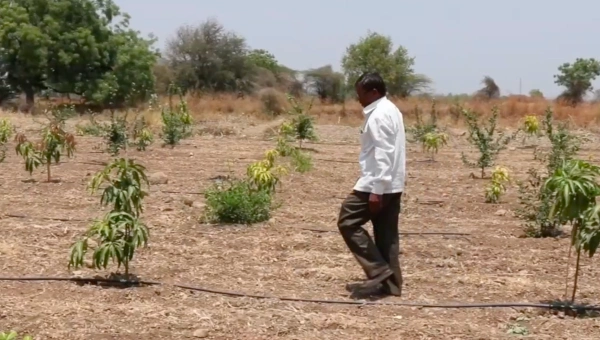
Arti Dhar of Farmers for Forest Pitches at Fast Forward Demo Day 2024
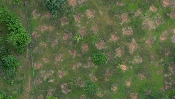
Farmers for Forests uses drone-based AI to monitor agroforestry, enabling carbon sequestration and resilient incomes.